Severe Storm Threat Continues Across Kansas and Missouri, Residents Urged to Stay Weather Aware
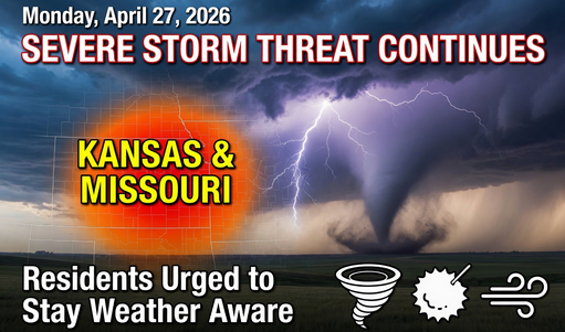
Severe weather remained a major concern across parts of Kansas and Missouri on Monday morning as thunderstorms moved through the region, bringing the risk of damaging winds, large hail, heavy rainfall, flash flooding, and isolated tornado warnings.
Weather officials advised residents to stay alert through at least 10:00 a.m., with the most active threat expected during the early morning hours. While the tornado risk remained relatively low in some areas, flooding, strong winds, and hail were considered the primary concerns.
In the Topeka area, forecasters continued monitoring storms through at least 8:00 a.m. Heavy rainfall created the possibility of flash flooding, especially in low-lying roads, underpasses, and poor-drainage areas. Drivers were strongly warned not to attempt crossing flooded streets.
Emergency officials repeated the important safety message: “Turn Around, Don’t Drown,” reminding people that even a small amount of moving water can be dangerous for vehicles. Driving through floodwaters can not only put lives at risk but may also cause serious damage to vehicles.
Meteorologists explained that once the morning storms moved out of the area, weather conditions were expected to improve significantly for the rest of the week. Although a few isolated showers or thunderstorms could still develop later in the day as a cold front passed through, most locations were expected to remain mostly dry.
Monday’s temperatures were forecast to vary widely depending on location. Areas in north-central Kansas were expected to stay in the low 60s, while regions closer to Interstate 35 could reach the mid-70s before cooler air moved in. By late afternoon, many places were expected to drop back into the 50s and 60s due to the cold front.
Winds were expected from the southeast before shifting westward at 10 to 15 miles per hour, with gusts reaching up to 25 miles per hour.
For Monday night, increasing cloud cover was expected with overnight temperatures falling into the low to mid-40s. Tuesday was forecast to remain mostly cloudy with cooler daytime highs ranging from the upper 50s to the mid-60s.
Looking ahead, the rest of the week is expected to stay relatively calm compared to the active weather pattern seen over the past several days. High temperatures should remain mostly in the 60s, with nighttime lows in the 40s. There is a small chance of showers or an isolated thunderstorm on Thursday, but current forecasts do not suggest a major severe weather event.
By the weekend, temperatures are expected to warm back into the 70s, although long-range forecast models still show some uncertainty about how warm conditions will become.
In the Kansas City metro area, severe weather alerts also remained active Monday morning. Damaging winds, hail, flash flooding, and isolated tornado warnings were all part of the threat.
A Tornado Warning was issued for Johnson and Miami counties in Kansas, along with Cass and Jackson counties in Missouri, prompting residents to remain weather aware and closely monitor local alerts.
Officials continue to advise residents across the region to keep emergency notifications turned on, stay indoors during severe storms, and avoid unnecessary travel until conditions improve.


1 Thought on “Severe Storm Threat Continues Across Kansas and Missouri, Residents Urged to Stay Weather Aware”